


Cincinnati’s craziest weather days
Recent abundant snow days are nothing compared to the strangest weather events in our area’s history.
Here in Cincinnati, we are all used to the crazy weather. One day it’s sunny and 50 degrees, the next day its 30 degrees and we have a snow day. It’s always a good decision to check the weather every day before you leave the house. As we look back on these crazy days of weather, do not be surprised if any of these days happen again.
Throughout Cincinnati weather history, there seems to be one common repetitive theme: The Ohio River floods. Since 1858, there have been 105 times that the river has been over its normal 52 feet crest. One flood in particular is considered the worst natural disaster in the city’s history. That flood is known as the “Great Flood of 1937.”
The flood of 1937 didn’t only affect Cincinnatians. The flood waters spilled from Pittsburgh, Pennsylvania and affected areas all the way to Cairo, Illinois. Rainfall was the major cause of the flood, having rained 6-12 inches in a single week in Cincinnati in the middle of winter. On January 26-27, 1937, the water level reached up to 80 feet, more than 30 feet above its normal crest.
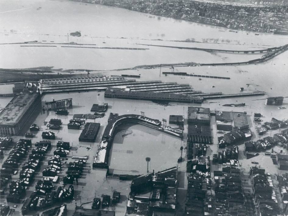
A view of Crosley Field flooded during the Flood of 1937
The aftermath events were the worst part about the flood. The “great flood” caused 350 deaths and left over a million people homeless. In Cincinnati, 12 square miles of city were flooded. The city’s main transportation (streetcar) could not run. The water supply was also cut off. Many Cincinnati landmarks were under water including Coney Island and Crosley Field. It still amazes me that the water reached Crosley Field. The last semi-big flood in my lifetime happened a few years ago in 2015.
The next craziest weather day(s) in Cincinnati happened in 1977 when the Ohio River froze. During that cold winter, the river froze between January 18-23 and January 30-February 7. This is an event that rarely happens. According to meteorologist Steve Raleigh, it’s a pretty simple phenomenon. “For the river to freeze, we would have to see weather conditions exceptionally frigid for an extended period of time. When the freeze happened, Cincinnati saw the coldest air we’ve EVER seen in this area. Record temperatures down to -24° smashed the almanac and we’ve never seen anything close since!”

Many of us know or have heard of someone who had walked on the ice that frigid winter. There were even some people at the time who drove a car across it. There has never been a river freeze like that on the Ohio River since.
September 14, 2008 was a recent Cincinnati weather day I will never forget. I was at the football game that day, Bengals vs Titans, when a huge windstorm from Hurricane Ike swept through the Queen City. At the game, it seemed like anything that wasn’t bolted down was flying around. The chain gang had a hard time holding up the first down marker. It was crazy!
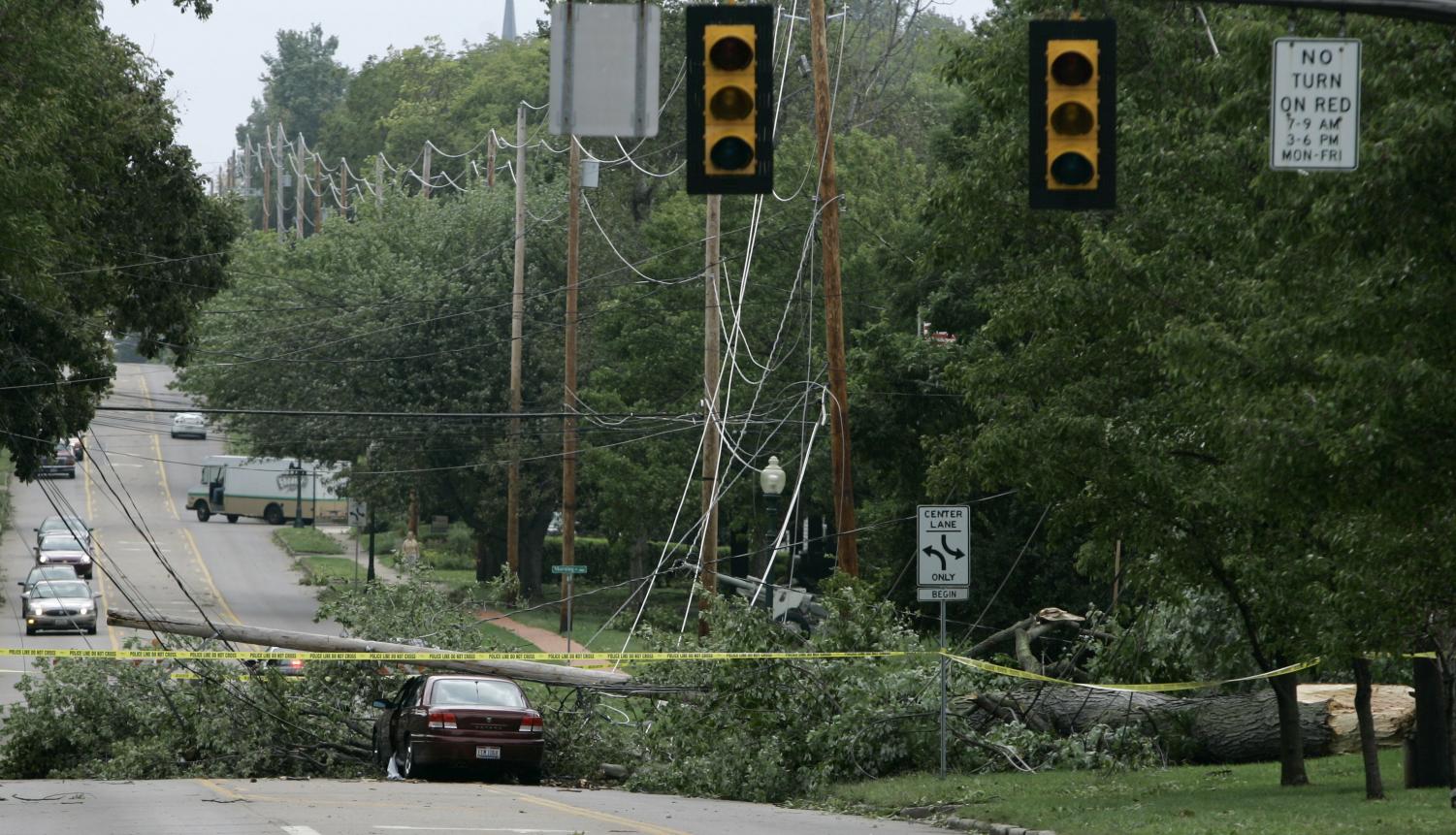
There were a lot of bad effects that came from Hurricane Ike when it blew through Cincinnati. Trees and power lines fell. Some people lost electric for several days. It was a scary time in Cincinnati. According to Raleigh, Cincinnati was just one of the cities to get hit with these winds. “The root cause of Cincinnati seeing the unusually high winds was the overall wind pattern across the country. Winds hit 81 mph as the remnants of Ike flowed around an area of high pressure situated in the southeast.”
For the rest of this winter, we could see some more snow days. According to the National Weather Service, it is predicted that Cincinnati could have a rainy transition over the next few months. However, hopefully, we can get a nice warm dry spring this year.
And remember, never try to predict Cincinnati weather.

This is my first year on The Purple Quill. I play hockey here at Elder. My favorite teams are Ohio State, Xavier, Reds, Bengals, and the Red Wings. ...


Quill Critic follower • Feb 13, 2018 at 11:44 am
Apparently, some people were driving cars on the river when it froze in 1977.
Great article, very well done, great pictures